
Understanding Dynamics of Land Use & Land Cover Change Using GIS & Change Detection Techniques in Tartous, Syria
Published 2023-07-13
Keywords
- LULCC Dynamics,
- Change Detection,
- Environmental Impact,
- Remote Sensing,
- GIS
- Sustainable Land Management,
- Environmental Conservation,
- Syria,
- IDPs,
- wars ...More
How to Cite
Copyright (c) 2023 Ali Younes, Adnan Ahmad, Ashok D. Hanjagi, Archana M. Nair

This work is licensed under a Creative Commons Attribution 4.0 International License.
Accepted 2023-07-13
Published 2023-07-13
Abstract
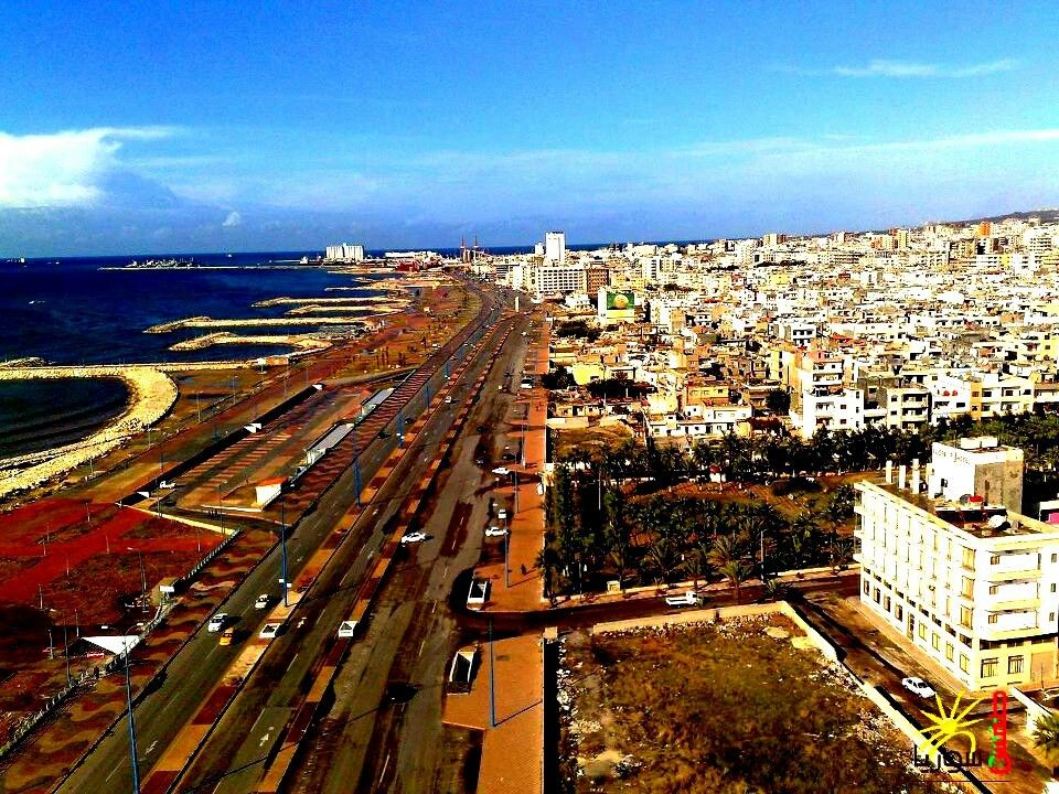
Although Tartous governorate accounts for only 1% of the total land area of Syria, it recorded the highest burden of Internally Displaced Persons (IDPs) during the Syrian crisis, with nearly half a million IDPs seeking refuge there in 2014. The simultaneous population growth and economic recession exacerbated the exploitation of natural resources and led to environmental degradation. The study aims to understand the dynamics of land use and land cover change (LULCC) in Tartous from 1987 to 2019 by comparing two periods, before and during the crisis, through the integration of remote sensing and GIS using the change detection-based post-classification comparison technique. The results showed significant LULCC that revealed significant changes during the crisis compared to before. However, most of the changes have negative environmental impacts, especially near built-up areas and in the northeast, where natural vegetation decreased by 40% by 2019, of which about 60% is due to agricultural expansion. Conversely, built-up areas have doubled, from 18 km2 in 1987 to 34 km2 in 2019, mainly at the expense of agricultural land. Meanwhile, agricultural land remained the predominant land use, with almost 74% of the study area reflecting primary economic activity. Nevertheless, a particular expansion was recorded during the crisis compared to before. The study highlights the impact of anthropogenic pressures on the environment, especially during wars. The findings provide important insights for policymakers and researchers concerned with sustainable land management and environmental conservation in war-affected regions. It also recommends developing comprehensive, multi-level plans to address the complex challenges in similar contexts.
Highlights:
- Tartous recorded the highest burden of IDPs in 2014, with more than half a million.
- The Post-Classification Comparison (PCC) technique is a powerful tool for monitoring the dynamics of LULCC.
- Significant LULCC was observed, with notable fluctuations during the crisis compared to before.
- Most of the LULCC had negative environmental impacts, especially in the western and northeastern regions.
- The growing population and economic recession in Syria put pressure on land resources and affect the environment in the search for livelihoods.
Downloads


References
- Abburu, S., & Babu Golla, S. (2015). Satellite Image Classification Methods and Techniques: A Review. International Journal of Computer Applica-tions, 119(8), 20–25. https://doi.org/10.5120/21088-3779
- Abdo, H. G. (2018). Impacts of war in Syria on vegetation dynamics and erosion risks in Safita area, Tartous, Syria. Regional Environmental Change, 18(6), 1707–1719. https://doi.org/10.1007/s10113-018-1280-3
- Abdo, H. G. (2020). Evolving a total-evaluation map of flash flood hazard for hydro-prioritization based on geohydromorphometric parameters and GIS–RS manner in Al-Hussain river basin, Tartous, Syria. Natural Hazards, 104(1), 681–703. https://doi.org/10.1007/s11069-020-04186-3
- Abeed, R., Clerbaux, C., Clarisse, L., Damme, M. van, Coheur, P. F., & Safieddine, S. (2021). A space view of agricultural and industrial changes during the Syrian civil war. Elementa: Science of the Anthropocene, 9(1), 1–13. https://doi.org/10.1525/elementa.2021.000041
- Aide, T. M., & Grau, H. R. (2004). Globalization, migration, and latin american ecosystems. Science, 305(5692), 1915–1916. https://doi.org/10.1126/science.1103179
- Al-Fares, W. (2013). Historical Land Use/Land Cover Classification using Remote Sensing—A Case Study of the Euphrates River Basin in Syria (1st ed.). Springer Cham. https://doi.org/10.1007/978-3-319-00624-6
- Al-Husban, Y., & Ayen, A. (2020). The impact of the syrian civil war on land use / land cover in al-yarmouk basin during 2010–2018. Geography, Environment, Sustainability, 13(2), 147–153. https://doi.org/10.24057/2071-9388-2018-73
- Alsafadi, K., Bi, S., Abdo, H. G., Al Sayah, M. J., Ratonyi, T., Harsanyi, E., & Mohammed, S. (2022). Spatial–temporal dynamic impact of changes in rainfall erosivity and vegetation coverage on soil erosion in the Eastern Mediterranean. Environmental Science and Pollution Research. https://doi.org/10.1007/s11356-022-24012-6
- Anand, A. (2012). Accuracy Assessment. In Remote Sensing and Image Interpretation (pp. 59–77). Indira Gandhi National Open University (IG-NOU). https://www.researchgate.net/publication/324943246_UNIT_14_ACCURACY_ASSESSMENT
- Attri, P., Chaudhry, S., & Sharma, S. (2015). Remote Sensing & GIS based Approaches for LULC Change Detection-A Review. International Journal of Current Engineering and Technology, 5(5), 3126–3137. https://www.researchgate.net/publication/325145097_Remote_Sensing_GIS_based_Approaches_for_LULC_Change_Detection_-_A_Review
- Butt, A., Shabbir, R., Ahmad, S. S., & Aziz, N. (2015). Land use change mapping and analysis using Remote Sensing and GIS: A case study of Simly watershed, Islamabad, Pakistan. Egyptian Journal of Remote Sensing and Space Science, 18, 251–259. https://doi.org/10.1016/j.ejrs.2015.07.003
- Cazabat, C. (2018). The Ripple Effect: Multidimensional Impacts of Internal Displacement (J. Lennard (ed.); Issue October). https://www.internal-displacement.org/publications/the-ripple-effect-economic-impacts-of-internal-displacement
- CBS. (2023). Statistical Abstract for Years: 2010, 2017, 2018, and 2019. Statistical Abstract. http://cbssyr.sy/yearbook-EN.htm
- Chaikaew, P. (2019). Land Use Change Monitoring and Modelling using GIS and Remote Sensing Data for Watershed Scale in Thailand. In L. C. Loures (Ed.), Land Use - Assessing the Past, Envisioning the Future (pp. 165–181). IntechOpen. https://doi.org/10.5772/intechopen.79167
- Chakraborty, A., Sachdeva, K., & Joshi, P. K. (2017). A Reflection on Image Classifications for Forest Ecology Management: Towards Landscape Mapping and Monitoring. In Handbook of Neural Computation (First, pp. 67–85). Academic Press. https://doi.org/10.1016/B978-0-12-811318-9.00004-1
- Chazdon, R. L., Lindenmayer, D., Guariguata, M. R., Crouzeilles, R., Rey Benayas, J. M., & Lazos Chavero, E. (2020). Fostering natural forest regen-eration on former agricultural land through economic and policy interventions. Environmental Research Letters, 15(043002). https://doi.org/10.1088/1748-9326/ab79e6
- Chen, D. M., & Stow, D. (2002). The effect of training strategies on supervised classification at different spatial resolutions. Photogrammetric Engineering and Remote Sensing, 68(11), 1155–1161. https://www.researchgate.net/publication/265659743_The_Effect_of_Training_Strategies_on_Supervised_Classification_at_Different_Spatial_Resolutions
- Congalton, R. G., & Green, K. (2019). Assessing the Accuracy of Remotely Sensed Data: Principles and Practices (3rd ed.). CRC Press. https://doi.org/https://doi.org/10.1201/9780429052729
- De Pauw, E., Oberle, A., & Zöbisch, M. (2004). Overview of land cover and land use in Syria: base year 1989/1990 (Issue 47). https://agris.fao.org/agris-search/search.do?recordID=QV2005000042
- Doocy, S., Lyles, E., Delbiso, T. D., Robinson, C. W., & The IOCC/GOPA Study Team. (2015). Internal displacement and the Syrian crisis: An analysis of trends from 2011-2014. Conflict and Health, 9(33), 1–11. https://doi.org/10.1186/s13031-015-0060-7
- Dudley, J. P., Ginsberg, J. R., Plumptre, A. J., Hart, J. A., & Campos, L. C. (2002). Effects of war and civil strife on wildlife and wildlife habitats. Conservation Biology, 16(2), 319–329. https://doi.org/10.1046/j.1523-1739.2002.00306.x
- Eklund, L., Degerald, M., Brandt, M., Prishchepov, A. V., & Pilesjö, P. (2017). How conflict affects land use: Agricultural activity in areas seized by the Islamic State. Environmental Research Letters, 12(054004). https://doi.org/10.1088/1748-9326/aa673a
- El-Hattab, M. M. (2016). Applying post classification change detection technique to monitor an Egyptian coastal zone (Abu Qir Bay). Egyptian Journal of Remote Sensing and Space Science, 19(1), 23–36. https://doi.org/10.1016/j.ejrs.2016.02.002
- Enderle, D. I. ., & Weih Jr., R. C. (2005). Integrating Supervised and Unsupervised Classification Methods to Develop a More Accurate Land Cover Classification. Journal of the Arkansas Academy of Science, 59. https://scholarworks.uark.edu/jaas/vol59/iss1/10/
- EOS. (2023). NASA’s Earth Observing System. https://eos.com/make-an-analysis/color-infrared/
- ESA. (2023). The European Space Agency ESA - SENTINEL-2 MISSION GUIDE. https://sentinel.esa.int/web/sentinel/missions/sentinel-2
- ESRI. (2023a). Accuracy Assessment for Image Classification. Environmental Systems Research Institute. https://desktop.arcgis.com/en/arcmap/latest/manage-data/raster-and-images/accuracy-assessment-for-image-classification.htm
- ESRI. (2023b). Equal To (Spatial Analyst). Environmental Systems Research Institute. https://pro.arcgis.com/en/pro-app/latest/tool-reference/spatial-analyst/equal-to.htm
- ESRI. (2023c). How the relational math tools work. Environmental Systems Research Institute. https://pro.arcgis.com/en/pro-app/latest/tool-reference/spatial-analyst/h-how-the-relational-math-tools-work.htm
- Fang, Z., Ding, T., Chen, J., Xue, S., Zhou, Q., Wang, Y., Wang, Y., Huang, Z., & Yang, S. (2022). Impacts of land use/land cover changes on ecosys-tem services in ecologically fragile regions. Science of The Total Environment, 831(154967). https://doi.org/10.1016/j.scitotenv.2022.154967
- Faour, G., & Fayad, A. (2014). Water Environment in the Coastal Basins of Syria - Assessing the Impacts of the War. Environmental Processes, 1, 533–552. https://doi.org/10.1007/s40710-014-0043-5
- Ferraris, V., Dobigeon, N., Wei, Q., & Chabert, M. (2017). Robust Fusion of Multiband Images With Different Spatial and Spectral Resolutions for Change Detection. IEEE Transactions on Computational Imaging, 3(2), 175–186. https://doi.org/10.1109/tci.2017.2692645
- Finegold, Y., & Ortmann, A. (2016). Map accuracy assessment and area estimation : a practical guide. In National forest monitoring assessment working paper (46/E). Food and Agriculture Organization of the United Nations (FAO). https://www.fao.org/documents/card/en?details=e5ea45b8-3fd7-%2F
- Foody, G. M., & Mathur, A. (2004). Toward intelligent training of supervised image classifications: Directing training data acquisition for SVM classification. Remote Sensing of Environment, 93(1–2), 107–117. https://doi.org/10.1016/j.rse.2004.06.017
- Geist, H. J., & Lambin, E. F. (2002). Proximate causes and underlying driving forces of tropical deforestation. BioScience, 52(2), 143–150. https://doi.org/10.1641/0006-3568(2002)052[0143:PCAUDF]2.0.CO;2
- Halder, J. C. (2018). Population change and land use dynamics: A case study of Paschim Medinipur District, West Bengal, India. European Journal of Geography, 9(3), 23–44. https://www.eurogeojournal.eu/index.php/egj/article/view/45
- Hammad, M., Mucsi, L., & van Leeuwen, B. (2018). Land Cover Change Investigation in the Southern Syrian Coastal Basins During the Past 30-Years Using Landsat Remote Sensing Data. Journal of Environmental Geography, 11(1–2), 45–51. https://doi.org/10.2478/jengeo-2018-0006
- Hao, H. mei, & Ren, Z. yuan. (2009). Land Use/Land Cover Change (LUCC) and Eco-Environment Response to LUCC in Farming-Pastoral Zone, China. Agricultural Sciences in China, 8(1), 91–97. https://doi.org/10.1016/S1671-2927(09)60013-4
- Hassan, Z., Shabbir, R., Ahmad, S. S., Malik, A. H., Aziz, N., Butt, A., & Erum, S. (2016). Dynamics of land use and land cover change (LULCC) using geospatial techniques: a case study of Islamabad Pakistan. SpringerPlus, 5(812). https://doi.org/10.1186/s40064-016-2414-z
- Heidarlou, H. B., Shafiei, A. B., Erfanian, M., Tayyebi, A., & Alijanpour, A. (2020). Armed conflict and land-use changes: Insights from Iraq-Iran war in Zagros forests. Forest Policy and Economics, 118(102246). https://doi.org/10.1016/j.forpol.2020.102246
- Hu, C., Song, M., & Zhang, A. (2023). Dynamics of the eco-environmental quality in response to land use changes in rapidly urbanizing areas: A case study of Wuhan, China from 2000 to 2018. Journal of Geographical Sciences, 33, 245–265. https://doi.org/10.1007/s11442-023-2081-2
- Ibrahim, W. Y., Batzli, S., & Menzel, W. P. (2014). Agricultural policy effects on land cover and land use over 30 years in Tartous, Syria, as seen in Landsat imagery. Journal of Applied Remote Sensing, 8(083506). https://doi.org/10.1117/1.jrs.8.083506
- IPCC. (2019). Climate Change and Land: An IPCC Special Report on climate change, desertification, land degradation, sustainable land manage-ment, food security, and greenhouse gas fluxes in terrestrial ecosystems. https://www.ipcc.ch/srccl/
- Jaafar, H. H., Zurayk, R., King, C., Ahmad, F., & Al-Outa, R. (2015). Impact of the Syrian conflict on irrigated agriculture in the Orontes Basin. Inter-national Journal of Water Resources Development, 31(3), 436–449. https://doi.org/10.1080/07900627.2015.1023892
- Jain, S. ., & Singh, V. . (2003). Reservoir sedimentation. In Developments in Water Science (Vol. 51, Issue C, pp. 681–741). Elsevier. https://doi.org/10.1016/S0167-5648(03)80066-7
- Kafy, A. Al, Rahman, M. S., Faisal, A. Al, Hasan, M. M., & Islam, M. (2020). Modelling future land use land cover changes and their impacts on land surface temperatures in Rajshahi, Bangladesh. Remote Sensing Applications: Society and Environment, 18(100314). https://doi.org/10.1016/j.rsase.2020.100314
- Khandve, P. V, & Mokadam, A. M. (2011). Application of GIS in Environmental Engineering. National Conference on Environment Pollution and Management, 244–250. https://www.researchgate.net/publication/292695439_Application_of_GIS_in_Environmental_Engineering
- Kraemer, H. C. (2015). Kappa Coefficient. Wiley StatsRef: Statistics Reference Online, 1–4. https://doi.org/10.1002/9781118445112.stat00365.pub2
- Krishnan, S., & Firoz, M. (2021). Impact of land use and land cover change on the environmental quality of a region: A case of Ernakulam district in Kerala, India. Regional Statistics, 11(2), 102–135. https://doi.org/10.15196/RS110205
- Kulo, N. (2018). Benefits of the Remote Sensing Data Integration. 1st Western Balkan Conference on GIS, Mine Surveying, Geodesy and Geo-matic, 0–14. https://www.researchgate.net/publication/329443299_Benefits_of_the_Remote_Sensing_Data_Integration
- Lam, N. S. N. (2008). Methodologies for mapping land cover/land use and its change. Advances in Land Remote Sensing: System, Modeling, Inver-sion and Application, 341–367. https://doi.org/10.1007/978-1-4020-6450-0_13
- Lambin, E. F., & Meyfroidt, P. (2011). Global land use change, economic globalization, and the looming land scarcity. Proceedings of the National Academy of Sciences of the United States of America (PNAS), 108(9), 3465–3472. https://doi.org/10.1073/pnas.1100480108
- Lambin, E. F., Turner, B. L., Geist, H. J., Agbola, S. B., Angelsen, A., Bruce, J. W., Coomes, O. T., Dirzo, R., Fischer, G., Folke, C., George, P. S., Homewood, K., Imbernon, J., Leemans, R., Li, X., Moran, E. F., Mortimore, M., Ramakrishnan, P. S., Richards, J. F., … Xu, J. (2001). The causes of land-use and land-cover change: Moving beyond the myths. Global Environmental Change, 11(4), 261–269. https://doi.org/10.1016/S0959-3780(01)00007-3
- Landholm, D. M., Pradhan, P., & Kropp, J. P. (2019). Diverging forest land use dynamics induced by armed conflict across the tropics. Global Environmental Change, 56, 86–94. https://doi.org/10.1016/j.gloenvcha.2019.03.006
- Li, A., & Deng, W. (2017). Land use/cover change and its eco-environmental responses in Nepal: An overview. In W. Zhao, A. Li, & W. Deng (Eds.), Land use/cover change and its eco-environmental responses in Nepal (pp. 1–13). Springer Geography. https://doi.org/10.1007/978-981-10-2890-8_1
- Lu, D., & Weng, Q. (2007). A survey of image classification methods and techniques for improving classification performance. International Jour-nal of Remote Sensing, 28(5), 823–870. https://doi.org/10.1080/01431160600746456
- Mallupattu, P. K., & Sreenivasula Reddy, J. R. (2013). Analysis of land use/land cover changes using remote sensing data and GIS at an Urban Area, Tirupati, India. The Scientific World Journal, 2013(268623), 1–7. https://doi.org/10.1155/2013/268623
- McGlynn, B. L., & Seibert, J. (2003). Distributed assessment of contributing area and riparian buffering along stream networks. Water Resources Research, 39(4), 1–7. https://doi.org/10.1029/2002WR001521
- McHugh, M. L. (2012). Lessons in biostatistics interrater reliability : the kappa statistic. Biochemica Medica, 22(3), 276–282. https://pubmed.ncbi.nlm.nih.gov/23092060/
- Mohajane, M., Essahlaoui, A., Oudija, F., Hafyani, M. El, Hmaidi, A. El, Ouali, A. El, Randazzo, G., & Teodoro, A. C. (2018). Land use/land cover (LULC) using landsat data series (MSS, TM, ETM+ and OLI) in azrou forest, in the central middle atlas of Morocco. Environments, 5(12), 1–16. https://doi.org/10.3390/environments5120131
- Mohamed, M. A. (2021a). An assessment of forest cover change and its driving forces in the syrian coastal region during a period of conflict, 2010 to 2020. Land, 10(2), 1–25. https://doi.org/10.3390/land10020191
- Mohamed, M. A. (2021b). Spatiotemporal impacts of urban land use/land cover changes on land surface temperature: A comparative study of damascus and aleppo (syria). Atmosphere, 12(8), 1–26. https://doi.org/10.3390/atmos12081037
- Mohamed, M. A., Anders, J., & Schneider, C. (2020). Monitoring of Changes in Land Use/Land Cover in Syria from 2010 to 2018 Using Multitem-poral Landsat Imagery and GIS. Land, 9(7). https://doi.org/10.3390/land9070226
- Mohammed, S., Abdo, H. G., Szabo, S., Pham, Q. B., Holb, I. J., Linh, N. T. T., Anh, D. T., Alsafadi, K., Mokhtar, A., Kbibo, I., Ibrahim, J., & Rodrigo-Comino, J. (2020). Estimating human impacts on soil erosion considering different hillslope inclinations and land uses in the coastal region of syria. Water, 12(10). https://doi.org/10.3390/w12102786
- Morgan, G. R., & Hodgson, M. E. (2021). A Post-Classification Change Detection Model with Confidences in High Resolution Multi-Date sUAS Imagery in Coastal South Carolina. International Journal of Remote Sensing, 42(11), 4309–4336. https://doi.org/10.1080/01431161.2021.1890266
- Mosammam, H. M., Nia, J. T., Khani, H., Teymouri, A., & Kazemi, M. (2017). Monitoring land use change and measuring urban sprawl based on its spatial forms: The case of Qom city. Egyptian Journal of Remote Sensing and Space Science, 20(1), 103–116. https://doi.org/10.1016/j.ejrs.2016.08.002
- Müller, M. F., Yoon, J., Gorelick, S. M., Avisse, N., & Tilmant, A. (2016). Impact of the Syrian refugee crisis on land use and transboundary fresh-water resources. Proceedings of the National Academy of Sciences of the United States of America (PNAS), 113(52), 14932–14937. https://doi.org/10.1073/pnas.1614342113
- Murillo-Sandoval, P. J., Gjerdseth, E., Correa-Ayram, C., Wrathall, D., Van Den Hoek, J., Dávalos, L. M., & Kennedy, R. (2021). No peace for the forest: Rapid, widespread land changes in the Andes-Amazon region following the Colombian civil war. Global Environmental Change, 69(102283). https://doi.org/10.1016/j.gloenvcha.2021.102283
- NASA. (2023a). ASTER - Advanced Spaceborne Thermal Emission and Reflection Radiometer. TERRA. https://terra.nasa.gov/about/terra-instruments/aster
- NASA. (2023b). How to Interpret Common False Color Images. Earth Observatory. https://earthobservatory.nasa.gov/features/FalseColor/page6.php
- Nguyen, C. T., Chidthaisong, A., Diem, P. K., & Huo, L.-Z. (2021). A Modified Bare Soil Index to Identify Bare Land Features during Agricultural Fallow-Period in Southeast Asia Using Landsat 8. Land, 10(3). https://doi.org/10.3390/land10030231
- Nielsen, D. C., & Calderón, F. J. (2011). Fallow Effects on Soil. In J. L. Hatfield & T. J. Sauer (Eds.), Soil Management: Building a Stable Base for Agriculture (pp. 287–300). American Society of Agronomy, Soil Science Society of America. https://doi.org/10.2136/2011.soilmanagement.c19
- OCHA. (2014). Syrian Arab Republic: Governate Profiles. In United Nations Office for the Coordination of Humanitarian Affairs. https://www.unocha.org/
- Omusotsi, O. G. (2019). Role of GIS as a Tool for Environmental Planning and Management. International Journal of Research in Environmental Science (IJRES), 5(1). https://doi.org/10.20431/2454-9444.0501002
- Pandian, M., Rajagopal, N., Sakthivel, G., & Amrutha, D. . (2014). Land Use and Land Cover Change Detection Using Remote Sensing and GIS in Parts of Coimbatore and Tiruppur Districts, Tamil Nadu, India. International Journal of Remote Sensing & Geoscience (IJRSG), 3(1). https://www.researchgate.net/publication/266210112_LAND_USE_AND_LAND_COVER_CHANGE_DETECTION_USING_REMOTE_SENSING_AND_GIS_IN_PARTS_OF_COIMBATORE_AND_TIRUPPUR_DISTRICTS_TAMIL_NADU_INDIA
- Park, N., Kim, Y., & Kwak, G.-H. (2019). An Overview of Theoretical and Practical Issues in Spatial Downscaling of Coarse Resolution Satellite-derived Products. Korean Journal of Remote Sensing, 35(4), 589–607. https://doi.org/10.7780/kjrs.2019.35.4.8
- Parveen, S., Basheer, J., & Praveen, B. (2018). a Literature Review on Land Use Land Cover Changes. International Journal of Advanced Research, 6(7), 1–6. https://doi.org/10.21474/ijar01/7327
- Pauleit, S., Ennos, R., & Golding, Y. (2005). Modeling the environmental impacts of urban land use and land cover change—a study in Mersey-side, UK. Landscape and Urban Planning, 71(2–4), 295–310. https://doi.org/10.1016/j.landurbplan.2004.03.009
- Pickering, J., Tyukavina, A., Khan, A., Potapov, P., Adusei, B., Hansen, M. C., & Lima, A. (2021). Using multi-resolution satellite data to quantify land dynamics: Applications of planetscope imagery for cropland and tree-cover loss area estimation. Remote Sensing, 13(11). https://doi.org/10.3390/rs13112191
- Porwal, S., & Katiyar, S. K. (2014). Performance evaluation of various resampling techniques on IRS imagery. 7th International Conference on Contemporary Computing, (IC3), 489–494. https://doi.org/10.1109/IC3.2014.6897222
- Rahaman, S., Kumar, P., Chen, R., Meadows, M. E., & Singh, R. B. (2020). Remote Sensing Assessment of the Impact of Land Use and Land Cover Change on the Environment of Barddhaman District, West Bengal, India. Frontiers in Environmental Science, 8. https://doi.org/10.3389/fenvs.2020.00127
- Rahmoun, T., Zhao, W., Hammad, M., & Hassan, M. (2018). Ruralization vs. Urbanization Sprawl as Guiding Regional Planning: Development Scenario for Rivers Watershed in the Southern Syrian Coastal Region. IOP Conference Series: Earth and Environmental Science, 151(012033). https://doi.org/10.1088/1755-1315/151/1/012033
- Rudel, T. K., Coomes, O. T., Moran, E., Achard, F., Angelsen, A., Xu, J., & Lambin, E. (2005). Forest transitions: Towards a global understanding of land use change. Global Environmental Change, 15(1), 23–31. https://doi.org/10.1016/j.gloenvcha.2004.11.001
- Rwanga, S. S., & Ndambuki, J. M. (2017). Accuracy Assessment of Land Use/Land Cover Classification Using Remote Sensing and GIS. International Journal of Geosciences, 8(4). https://doi.org/10.4236/ijg.2017.84033
- Santos, M. J., Smith, A. B., Dekker, S. C., Eppinga, M. B., Leitão, P. J., Moreno-Mateos, D., Morueta-Holme, N., & Ruggeri, M. (2021). The role of land use and land cover change in climate change vulnerability assessments of biodiversity: a systematic review. Landscape Ecology, 36, 3367–3382. https://doi.org/10.1007/s10980-021-01276-w
- Schowengerdt, R. A. (2007). Thematic Classification. In Remote Sensing - Models and Methods for Image Processing (Third, pp. 387–456, XXVII–XXXIII). Academic Press. https://doi.org/10.1016/b978-012369407-2/50012-7
- Seto, K. C., Güneralp, B., & Hutyra, L. R. (2012). Global forecasts of urban expansion to 2030 and direct impacts on biodiversity and carbon pools. Proceedings of the National Academy of Sciences of the United States of America (PNAS), 109(40), 16083–16088. https://doi.org/10.1073/pnas.1211658109
- Sharma, S., Hussain, S., & Singh, A. N. (2023). Impact of land use and land cover on urban ecosystem service value in Chandigarh, India: a GIS-based analysis. Journal of Urban Ecology, 9(1), 1–12. https://doi.org/10.1093/jue/juac030
- Sisodia, P. S., Tiwari, V., & Kumar, A. (2014). Analysis of Supervised Maximum Likelihood Classification for remote sensing image. International Conference on Recent Advances and Innovations in Engineering, ICRAIE 2014, 1–4. https://doi.org/10.1109/ICRAIE.2014.6909319
- Talukdar, S., Singha, P., Mahato, S., Shahfahad, Pal, S., Liou, Y.-A., & Rahman, A. (2020). Land-Use Land-Cover Classification by Machine Learning Classifiers for Satellite Observations — A Review. Remote Sensing, 12(7). https://doi.org/10.3390/rs12071135
- Tucker, C. J., Grant, D. M., & Dykstra, J. D. (2004). NASA’s global orthorectified landsat data set. Photogrammetric Engineering and Remote Sens-ing, 70(3), 313–322. https://doi.org/10.14358/PERS.70.3.313
- Twisa, S., & Buchroithner, M. F. (2019). Land-use and land-cover (LULC) change detection in Wami river basin, Tanzania. Land, 8(9). https://doi.org/10.3390/land8090136
- United Nations. (2019). World Urbanization Prospects: The 2018 Revision (ST/ESA/SER.A/420). In Department of Economic and Social Affairs, Population Division (2019). https://population.un.org/wup/Publications/
- USGS. (2023a). Common Landsat Band Combinations. United States Geological Survey. https://www.usgs.gov/media/images/common-landsat-band-combinations
- USGS. (2023b). USGS EROS Archive - Digital Elevation - Shuttle Radar Topography Mission (SRTM) 1 Arc-Second Global. United States Geological Survey. https://www.usgs.gov/centers/eros/science/usgs-eros-archive-digital-elevation-shuttle-radar-topography-mission-srtm-1
- USGS. (2023c). What are the band designations for the Landsat satellites? United States Geological Survey. https://www.usgs.gov/faqs/what-are-band-designations-landsat-satellites#:~:text=Landsat 1-5 Multispectral Scanner,106 mi by 115 mi)
- Vishwakarma, C. A., Thakur, S., Rai, P. K., Kamal, V., & Mukherjee, S. (2016). Changing land trajectories: A case study from india using a remote sensing based approach. European Journal of Geography, 7(2), 61–71. https://www.eurogeojournal.eu/index.php/egj/article/view/396
- Wallace, C. S. A., Thenkabail, P., Rodriguez, J. R., & Brown, M. K. (2017). Fallow-land Algorithm based on Neighborhood and Temporal Anomalies (FANTA) to map planted versus fallowed croplands using MODIS data to assist in drought studies leading to water and food security assess-ments. GIScience & Remote Sensing, 45(2). https://doi.org/10.1080/15481603.2017.1290913
- Wilson, S. A., & Wilson, C. O. (2013). Modelling the impacts of civil war on land use and land cover change within Kono District, Sierra Leone: A socio-geospatial approach. Geocarto International, 28(6), 476–501. https://doi.org/10.1080/10106049.2012.724456
- Winowiecki, L., Vågen, T. G., & Huising, J. (2015). Effects of land cover on ecosystem services in Tanzania: A spatial assessment of soil organic carbon. Geoderma, 263, 274–283. https://doi.org/10.1016/j.geoderma.2015.03.010
- Zakhem, B. A., & Hafez, R. (2010). Climatic factors controlling chemical and isotopic characteristics of precipitation in Syria. Hydrological Process-es, 24(18), 2641–2654. https://doi.org/10.1002/hyp.7646
- Zambon, I., Serra, P., Salvia, R., & Salvati, L. (2018). Fallow land, recession and socio-demographic local contexts: Recent dynamics in a mediterra-nean urban fringe. Agriculture (Switzerland), 8(10). https://doi.org/10.3390/agriculture8100159